Geospatial
solutions for
your projects
solutions for
your projects

Geospatial
solutions for
your projects
solutions for
your projects

Our Journey
Our experience is forged through the development of numerous projects with government institutions and private companies within Mexico and other Latin American countries such as El Salvador, Argentina, Chile, and Panama, among others. We work closely with our business partners and their technical experts, allowing us to offer high-quality, cutting-edge solutions to our clients.
Why we are different
Our focus is to get to know our client’s project and their needs and later work closely with them to implement business-friendly solutions that allow decision makers to make more informed and faster decisions.
We offer our clients an extensive range of data and solutions.
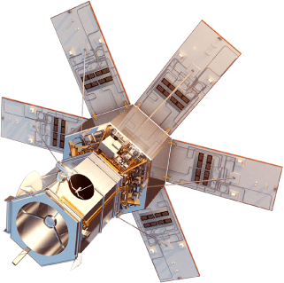
Partnering with the providers of the most sophisticated and comprehensive constellations like Maxar, Airbus, Planet, Capella Space, Head Aerospace, and SIIS is how we guarantee we’ll have the right data for their needs.
We also partner with CATALYST, a PCI Geomatics brand that offers Earth Observation solutions, Precisely, today’s leading data integrity company with a remarkable heritage, and Datamine, a pioneer at the forefront of digital mining technology.
We offer our clients an extensive range of data and solutions.
Partnering with the providers of the most sophisticated and comprehensive constellations like Maxar, Airbus, Planet, Capella Space, Head Aerospace, and SIIS is how we guarantee we’ll have the right data for their needs.
We also partner with CATALYST, a PCI Geomatics brand that offers Earth Observation solutions, Precisely, today’s leading data integrity company with a remarkable heritage, and Datamine, a pioneer at the forefront of digital mining technology.
Our purpose and values
The mission of ImagenGeo is to make users and potential users aware of the latest advances in geospatial technology and promote its use to make the use and conservation of national natural resources more efficiently, improve the productivity and performance of business resources, as well as be a solid source of work in constant growth that allows its members to have persistent personal, professional, and economic growth. Our mission is based on an ethics of respect, honesty, and professionalism. At ImagenGeo we are sure that Earth observation, together with remote sensing and data analysis, is a practice that provides unique information for the development of each country.
A wide range of solutions for your market and project.


Get in touch with ImagenGeo
Clients with
success stories
success stories


Business Partners